
Appalachian Trail/”The AT”): A 2,180-mile long distance 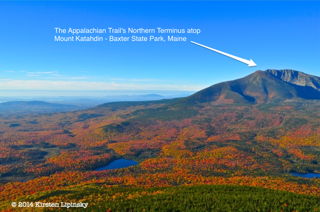 trail running from Maine to Georgia by way of New Hampshire, Vermont, Massachusetts, Connecticut, New York, New Jersey, Maryland, Pennsylvania, West Virginia, Virginia, Tennessee and North Carolina.
Arctic Alpine Zone: The colder, more fragile area above treeline on high peaks. It has its own ecosystem, with unique flora, fauna and wildlife not found at lower elevations.
Blazes: Painted marks on trees and rocks denoting  the direction and route of the trail.
Continental Divide Trail/”The CDT”: A long distance hiking trail spanning 3,100 miles from Canada to Mexico, by way of Montana, Idaho, Wyoming, Colorado and New Mexico.
Col: A pass between two mountains; the lowest point 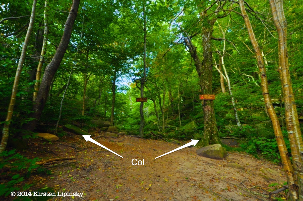 between two adjacent peaks.
Devil’s Path: A challenging 24-mile hiking trail with a 9,000  foot elevation gain connecting 5 of the Catskill 3500 (peaks over 3,500 feet). It includes (from East to West): Indian Head, Twin, Sugarloaf, Plateau, Hunter, & Westkill Mountains. The hiking trail involves just one road crossing.
Escarpment: A long ridge usually formed by a fracture in the 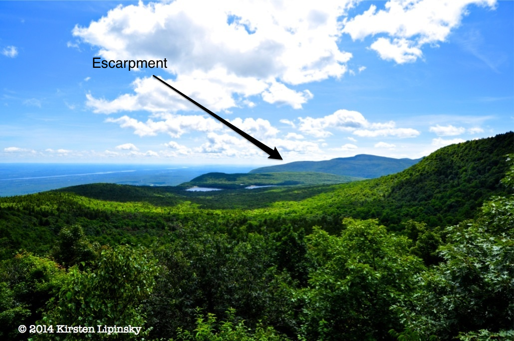 Earth’s crust. The Catskill Escarpment is comprised of (from South to North): Overlook Mountain, Plattekill Mountain, Kaaterskill High Peak, South Mountain, North-South Lake, North Mountain, Stoppel Point, Blackhead Mountain and Windham High Peak.
Fire Tower: A tower at high elevation that was used as a  lookout for fires over a wide area. Today they provide great 360 degree views for those who hike to them.
Markers: (See “Blazes”)
Pacific Crest Trail/”The PCT”: A 2,650-mile long distance hiking trail that travels from Canada to Mexico, by way of Washington, Oregon & California.
Puncheon/Planking: Planks of wood laid one after the other 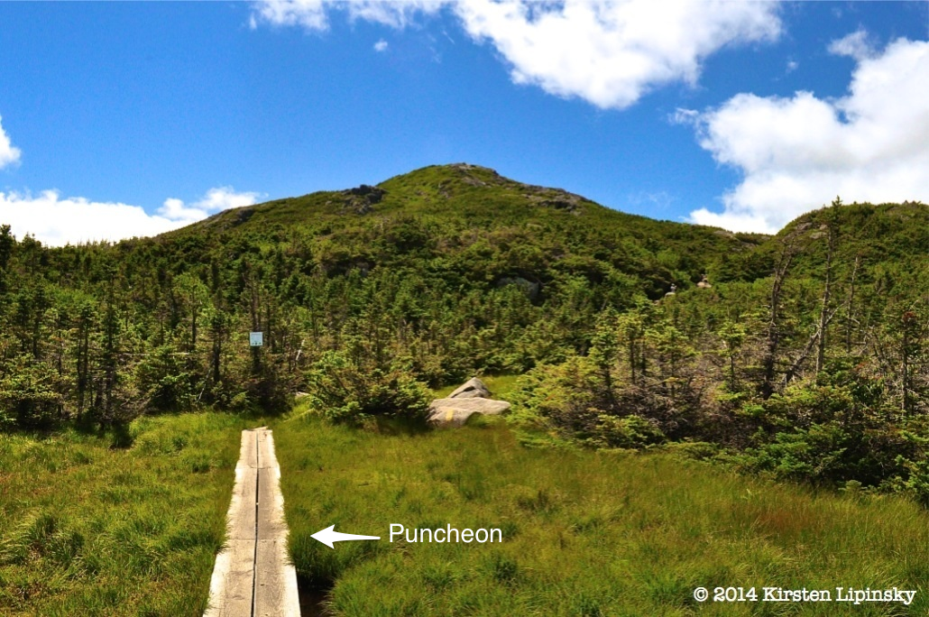 that are slightly elevated over a swamp or other wetland area; allows hikers to avoid walking through otherwise muddy/wet areas/streams.
Slide: Long, open faces of rock extending vertically down a 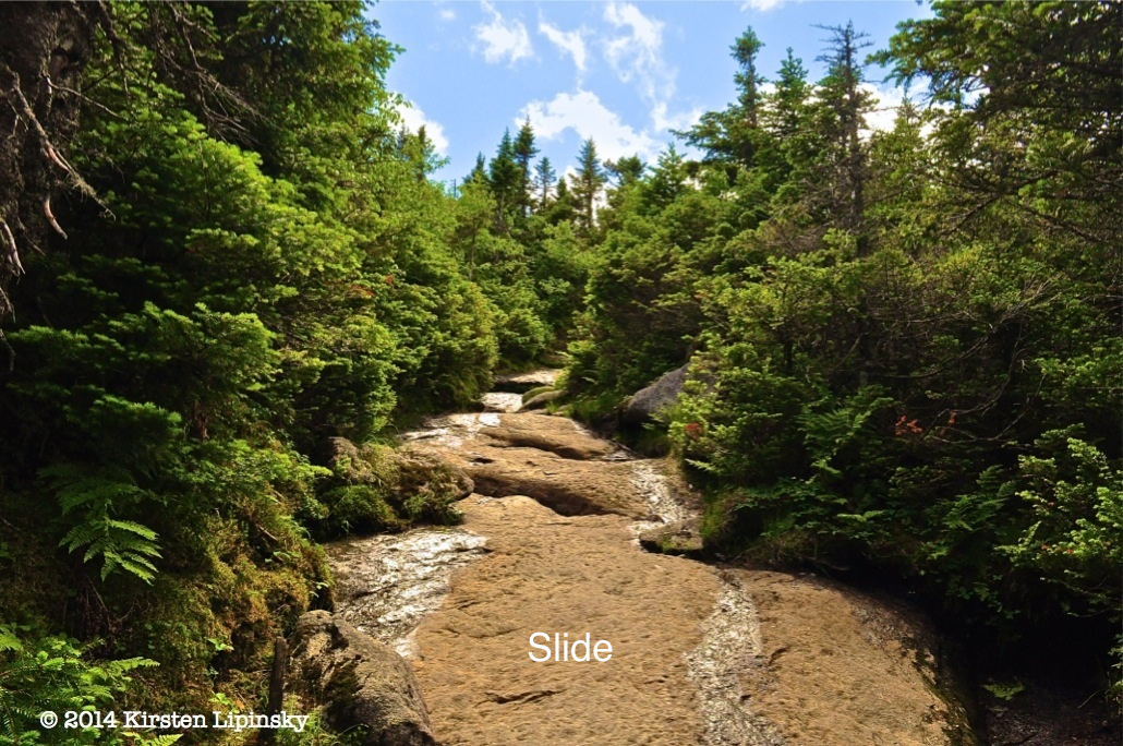 mountain that are created by weather, storms, and time. Hiking up and down slides provide relief from narrow trails, but also require balance, flexibility and agility to avoid fatal falls.
Spur Trail: A trail that extends off the main trail (usually  marked) that usually leads to an overlook, water source, lean-to or camping area.
Stile: An arrangement of steps that allows people to cross  fences, walls, etc.
Summit Canister: A cylindrical, waterproof & wildlife-proof 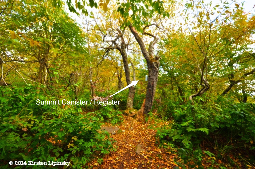 container holding a record of visitors to the summit.
Switchback: A 180° bend in the hiking trail that (usually)  makes a steep mountain easier to climb.
Thru-Hiking: Hiking the entirety of a long-distance trail. 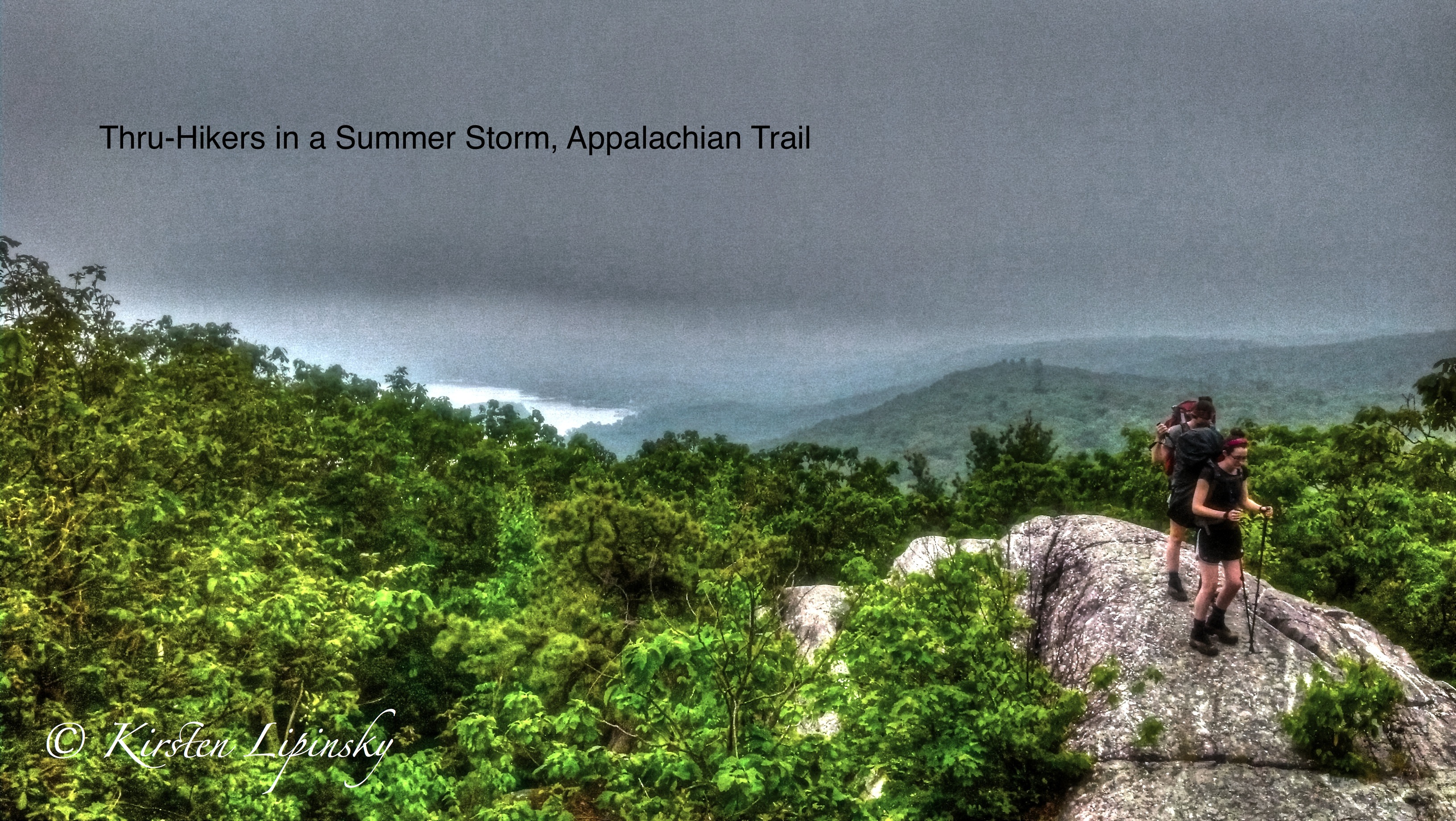
Trailhead: Where the trail begins and the sidewalk ends. 
