
Home⎟Hikes & Wanderings ⎟New York⎟Hudson Valley⎟Camp Smith Trail
Distance: 6 miles roundtrip
Time: 3 hours
Difficulty: Moderate
Elevation Gain: 1,250′
Dog Friendly: Yes.
A moderate hike with sweeping views of the Hudson River and its highland mountains, that steadily ascends North to Antho ny’s Nose on the cusp of a ridge.
Trailhead Directions: From the NYS Thruway, take the Palisades Interstate Parkway North to the Bear Mountain Traffic Circle and cross the Bear Mountain Bridge ($1.50 as of this 2016 writing). Bear to the right, south on US-202 E / US-6E as it weaves along the mountainside, exposing limited views of the Eastern edges of Bear Mountain State Park across the river. Just above the road is the trail you’ll soon be undertaking. Continue 2.6 miles from the bridge to the Bear Mountain Toll House Parking Lot on your left.
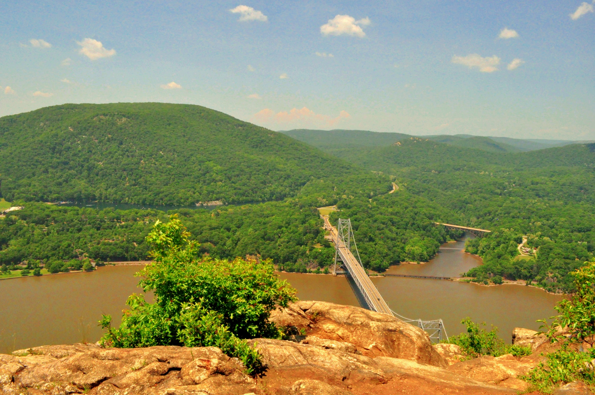
Hike Directions: From t he Bear Mountain Toll House Parking Lot, go north to the end of the parking lot, beyond the toll house you’ll find the blue blazed Camp Smith Trail. Pass a sign alerting against crossing a string barrier that separates the trail from the actual Camp Smith. Steadily ascend through forest that soon gives way to large boulders along a ridge. As you rise, the Bear Mountain Bridge comes into view. From the trail, it looks as if the bridge leads straight into the mountain tunnels of Manitou Mountain’s forest. Across the river, you’ll catch glimpses of Bear, West, Bald and Dunderberg Mountains burgeoning out of the landscape, as well as great views of Iona Island below. Continue along the ridge as the rocks give way to soft grasses, eventually leading
  you to an open intersection in the forest. It might not seem obvious here, but go left and you’ll find Anthony’s Nose.
Scenery: 8/10

1 reply »