
Home ⎟ Hikes & Wanderings ⎟ New York ⎟ Hudson Valley ⎜Pochuck Mountain (East Side Loop)
Distance: 3.17 mile loop; for the Hike up the West Side of Pochuck, click here.
Time: 2.5 hours
Difficulty: Moderate
Elevation Gain: 679 feet


Driving Directions: From the NYS Thruway, take exit 16 for NY-17 West. Take NY-17 West for about 10 miles to exit 126. Turn LEFT at the top of the ramp and continue onto NY-94 West for 5 miles to the traffic light in Florida, NY. Go straight at the traffic light, continuing onto Pumpkin Swamp Road and follow for 1.5 miles as you pass first a small residential area and then through open fields. At the end of the road, turn LEFT and take Pulaski Highway 5.41 miles to the traffic light in Pine Island Center. Continue straight through the light onto Glenwood Road and follow 2.1 miles to the Cider Mill Inn on your RIGHT.
Nearby Address: 207 Glenwood Road Pine Island, NY
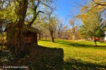
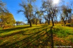
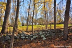
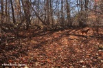
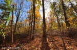
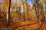
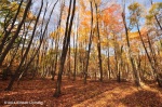
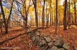
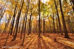
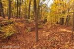
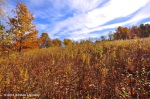
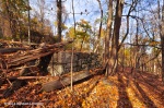
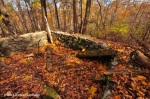
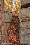
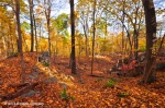
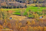
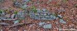
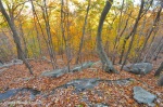
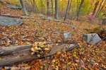
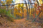
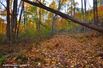
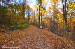
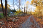
Hike Directions: Follow the trail from the parking lot of the Inn, uphill through an old orchard. Cross a fence and continue across two open fields, meeting a Revolutionary Era rock wall 0.17 miles into the hike. Turn LEFT and walk parallel to the wall for a tenth of mile, and as the trail disappears in front of you, turn RIGHT into the woods and walk directly uphill. You’ll pass through two stone walls, followed by a field (once a horse ring) coming in on your left. Continue passed the field, ascending slightly the left and behind the field now.
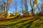
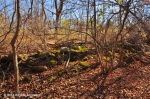
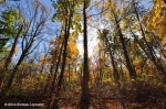
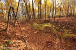
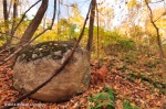
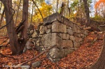
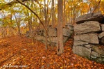
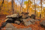
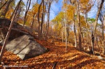
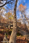
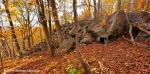
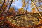
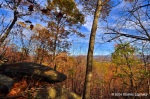
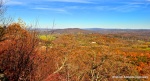
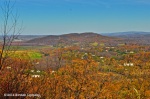
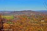
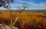
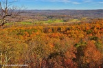
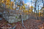
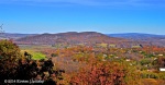
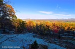
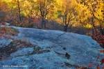
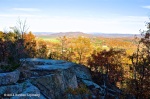
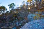
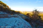
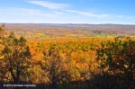
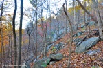
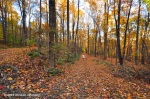
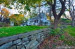
At 0.7 miles into the hike, reach an abandoned railroad bed and cross, continuing your ascent directly up the mountain soon meeting an old quarry road going uphill to the RIGHT. Follow the quarry road, a line of large boulders guiding your way until you reach another group of homestead ruins at 0.25 miles from the abandoned railroad crossing – this time an old farmhouse with a huge stone wall and stairs leading to the top. Take the stairs and continue uphill, curving to the RIGHT along the quarry road. Reach summit cliffs a little just a tenth of mile later and keep moving to the RIGHT. Your afforded wonderful north easterly views from here – looking out toward Mount Adam and Eve, Goose Pone, Sugar Loaf and Waywayanda Mountains. Be careful of the sharp cliff face, there is almost a straight drop down as you look down the vast emptiness of an old quarry’s carvings.
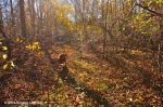
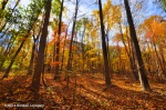
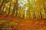
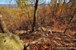
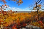
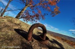
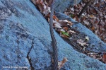
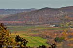
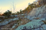
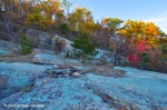
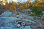
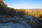
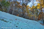
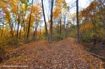
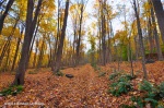
Continue uphill, reaching a woods road and turn RIGHT following it 0.18 miles North and slightly downhill to an old quarry with what seems like blue stones. The lookout from here is as wonderful as the previous one, but there’s more room here to move, standing amidst the ruins of an old quarry looking out on the world. After taking in the views, continue on the woods road as it descends slowly. When the trail disappears, continue on old green markers which turn RIGHT go downhill. If you choose to explore the beautiful state park land and are attempting to bushwack down the mountain, be sure to clear the quarry completely before the descent. The quarry stone is quite steep but descending on its South of North ends has proved safe albeit exhilarating.
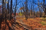
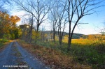
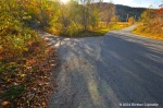
If your sticking to the green markers, they will take you down hill to an old woods road, turn LEFT and continue on the old woods road, still descending until you reach an intersection with the abandoned railroad bed you found before. Turn LEFT and a few paces later veer to the RIGHT to continue on the old woods road. A tenth of a mile beyond the intersection of railroad and woods road, you’ll pass a green house, continuing passed it on a packed dirt and stone road for 0.52 miles to its outlet at Newport Bridge Road. Turn RIGHT at Newport Bridge and walk a tenth of a mile to Glenwood Road. Turn RIGHT again on Glenwood and follow 0.22 miles back to the Inn.

